Hurricanes
What is a hurricane?
A hurricane is a violent warm-core tropical storm with a minimum wind speed of 119 km or (74 mph) rotating in a counter-clockwise spiral around a region of low pressure called the center of the eye.
The word hurricane was derived from the name for the Arawak God of Stormy Weather “Huraken”, and the Spanish word “Huracan” meaning ‘big wind’.
While hurricane winds move in a spiraling counter-clockwise direction, the hurricane itself moves with the basic motion of the trade winds in which it is embodied.
The official hurricane season is June 1 to November 30. The period is usually a rainy one even if a hurricane does not develop.
The weather pattern between June and December is significantly influenced by the Northward shift of the Inter-Tropical Convergence Zone and cyclonic instability, which leads to the formation of easterly waves, storms, and hurricanes.
The hurricane, composed of all the severe weather elements at their worst, is considered “The Greatest Storm” on earth.
A hurricane can dominate the ocean and lower atmospheric temperatures over tens of thousands of kilometres (square miles).


FAQ about Hurricane
The principal regions of hurricane origin vary during the season. Most early (June) storms originate in the Gulf of Mexico and the Western Caribbean. In July and August, the areas of most frequent origin shift eastward, and by September are located over the larger areas from the Bahamas south-eastward to the Lesser Antilles, and then eastward to south of the Cape Verde Islands, near the West coast of Africa. After mid-September, the principal areas of origin shift back to the western Caribbean and the Gulf of Mexico.
On average, six Atlantic hurricanes occur per year. However, there are significant deviations from this average. In 1916 and 1950, eleven hurricanes were observed and no hurricanes were observed in 1907 and 1914. During 1893, 1959 and 1961 seasons, four hurricanes were observed in progress at the same time.
Hurricanes develop over warm tropical waters. The energy necessary for its development comes from the warm ocean waters over which it passes. Through the process of evaporation energy stored in the ocean is lifted into the storm and then released during condensation.
The warmer the water surface over which a tropical wind system passes, the more energy is available for the storm.
Hurricanes are formed when damp air rises from the surface of warm tropical seas. The sun heats the air and, as the air rises, there is a powerful updraft. This cools and turns into rain.
The updraft is kept fuelled as more hot moist air rises. The movement of the earth in an eastwardly direction pushes the moist air currents to one side resulting in hurricanes moving in a counter-clockwise direction.
A potential hurricane goes through four basic phases before it attains hurricane strength. These are:
Phase 1 – Tropical Disturbance:
A system in the trade wind easterlies which gives rise to a discrete area of cloudiness with embedded showers and thunderstorms.
Phase 2 – Tropical Depression:
This system has definite counter-clockwise wind circulation in which maximum sustained surface wind is less than 61 km/h (38 mph).
Phase 3 – Tropical Storm:
This phase immediately precedes the hurricane. Tropical storms are systems with definite counter-clockwise wind circulation in which the maximum sustained surface wind is greater than 61 km/h (38 mph) but not more than 119 km/h (74 mph). It is at this stage the storm is given a name.
Phase 4 – Hurricane:
The final stage is the hurricane, with a maximum wind speed of 119 km/h (74 mph) and over. The system is now mature and the eye is well defined. If atmospheric conditions are right, it can strengthen.
This system has definite counter-clockwise wind circulation in which maximum sustained surface wind is less than 61 km/h (38 mph).
| Category | (km/h) | (mph) | (knots) | Storm Surge (ft) | Damage |
|---|---|---|---|---|---|
| 1 | 119-153 | 74-95 | 64-82 | 4-5 | Minimal |
| 2 | 154-177 | 96-110 | 83-95 | 6-8 | Moderate |
| 3 | 178-208 | 111-129 | 96-112 | 9-12 | Extensive |
| 4 | 209-251 | 130-156 | 113-136 | 13-18 | Extreme |
| 5 | >252 | >157 | >137 | >19 | Catastrophic |
- Minimal: damage primarily to shrubbery, trees, and foliage; some coastal flooding and possible minor damage to boats.
- Moderate: considerable damage to trees; some roof, window and door damage; coastal flooding requiring evacuation; damage to boats.
- Extensive: large trees were blown down; structural damage to small buildings; serious flooding near the coast; evacuation necessary; coastal structures damaged or destroyed.
- Extreme: extensive destruction of trees and buildings; large-scale flooding; major damage to low structures within about 450m of shore; possible evacuation from the low ground within eight to 16km of the shore.
- Catastrophic: trees down; extensive building damage; the coastal area below 3m flooded up to 10km inland; major damages to coastal structures; beaches eroded; massive evacuation near the coast. Damage primarily to shrubbery, trees, and foliage; some coastal flooding and possible minor damage to boats.
More FAQ about Hurricane
Every year, since 1953, the National Hurricane Center in Florida generates a list of pre-approved names for tropical storms and hurricanes. It is much easier to identify a storm by a name than by using the older method of latitude and longitude.
These lists first consisted only of female names. This changed in 1979, and today the lists alternate between male and female names. Each generated list contains names that begin from A to W, but exclude names that begin with a Q, U or Z.
Did You Know…? |
For hundreds of years, hurricanes in the West Indies were named after the particular saint’s day on which the hurricane occurred. For example, hurricane “San Felipe I” struck Puerto Rico on September 13, 1876 and hurricane “San Felipe II” struck Puerto Rico again on the same day in 1928. |
There are six lists of hurricane names that are reused every six years. This list changes, however, when a hurricane name is retired. Hurricanes that were unusually damaging and had a severe impact on the lives and the economy of a particular country or region are retired and not used for at least ten years.
Wind Activity:
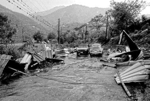
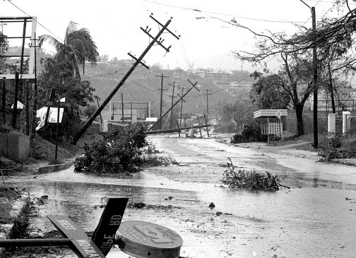
Normally between 119 km (74 mph) and 320 km (200 mph). This normally causes damage to buildings and other structures, destroys crops especially grains and uproots trees and disrupts electricity and telephone lines. Objects such as signs, roofing material, and small items left outside become flying missiles in hurricanes.
Very Heavy Rainfall:
This often results in flooding causing damage to houses, excessive erosion, and landslides, especially where unstable soil exists.
Storm Surges:
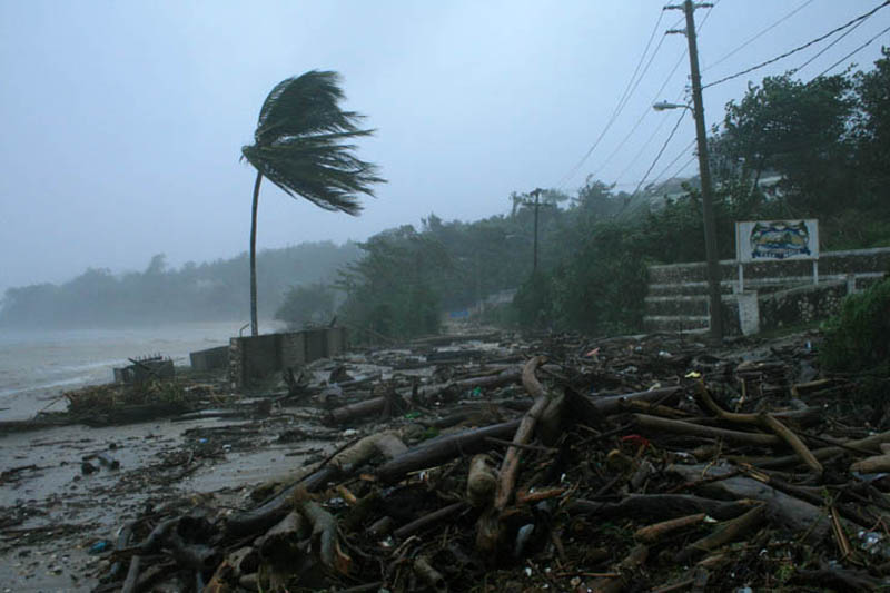
Storm surges appear as powerful water bulldozers that sweep inland across coastlines, sweeping everything in its path. The storm surge is a rise in water level that can take hours to reach its maximum height. It is a huge wave that can extend as far as 80 km (50 miles) wide.
Water starts to rise as the storm approaches and continues to rise faster as the centre of the hurricane nears the coast.
The stronger the hurricane and the shallower the offshore water the higher and more powerful the surge will be. This can also cause rapid flooding forced the evacuation and also drowning. Along the coast, storm surges are the greatest threat to life and property.
Eye:
In the eye or centre of the hurricane, the winds are light and the skies clear or partly cloudy. Maximum force winds and torrential rains surround this calm centre of the hurricane.
The passing of this quiet area signals a change of direction in the winds. That is, the destructive force of the hurricane will be coming from the other direction.


